|
|
Post by wimblephil on May 31, 2015 15:30:33 GMT
Now thats more like it. It did look surprising 8bit-esque! Haha. Good attempt my someone though!
|
|
|
|
Post by alholmes on May 31, 2015 19:15:36 GMT
Surprised that the tube map doesn't include any mention of the restricted operating hours for Romford - Upminster (and Emerson park station) when it does for the Waterloo & City line.
Copies of the map in the leaflet racks at Euston Square this evening.
|
|
|
|
Post by rsdworker on May 31, 2015 20:38:06 GMT
i find odd - the overground map has no bakerloo line on it just starts from Harrow &
Wealdstone to queens park - someone looks like forget about bakerloo line already existed there all of time
|
|
Deleted
Deleted Member
Posts: 0
|
Post by Deleted on May 31, 2015 21:39:57 GMT
Did anyone else notice that the new standard tube map and the TfL rail map on the TfL website aren't true pdf maps but pdf's created from jpg's? If you zoom in you can see the graininess.
|
|
Chris M
Global Moderator
Forum Quizmaster
Always happy to receive quiz ideas and pictures by email or PM
Posts: 19,402
|
Post by Chris M on May 31, 2015 22:44:45 GMT
There is no change in this regard from other recent standard tube maps.
|
|
gantshill
I had to change my profile pic!
Posts: 1,347
|
Post by gantshill on May 31, 2015 23:10:03 GMT
I picked up the May map at St Paul's around 3pm. They were at Clapham Common by the time we got back there, although it had been the December 2014 version earlier in the morning. It took me a while to notice that on the pocket map, the Central line just dips down by Bank (like the December 2014 version), but the poster map(see picture above) has the Central line dipped for longer. I am sure that there are other differences, but I haven't time to check.
|
|
Deleted
Deleted Member
Posts: 0
|
Post by Deleted on May 31, 2015 23:29:29 GMT
There is no change in this regard from other recent standard tube maps. Are you sure? The December 2014 version I have saved on my system is a proper vector image, I believe :S |
|
Deleted
Deleted Member
Posts: 0
|
Post by Deleted on May 31, 2015 23:32:46 GMT
This is the only version that is like this. All others were true pdf's, I wonder why
|
|
|
|
Post by norbitonflyer on Jun 1, 2015 9:40:38 GMT
i find odd - the overground map has no bakerloo line on it just starts from Harrow & Wealdstone to queens park - someone looks like forget about Bakerloo line already existed there all of time The Overground map posted by Pridley (May 30th 21:05)is intended as an in-car map and thus only shows lines operated by LOROL, and interchanges with those lines. The only useful interchanges between the Bakerloo Line and the Overground are at Queens Park and (for NLL/WLL users) Willesden Junction. (Why would anyone change from Overground to Bakerloo at Harlesden, for example). For the same reason, there is no mention of the District at Kew or Richmond. Likewise, Metropolitan in-car maps only show interchange with the Piccadilly at Rayners Lane, and not at all stations from there to Uxbridge. That both routes serve the stations is useful information when you are on the station, but not when you are already on the train. |
|
|
|
Post by Dstock7080 on Jun 1, 2015 18:27:57 GMT
pocket map, cover: 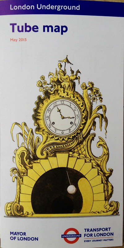 pocket map: 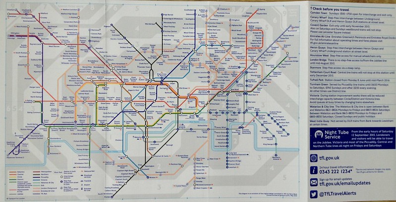  alternative adverts:  differences December 2014-May 2015: - Tufnell Park; station struck-through † added - London Bridge; † added - West Ham (Jubilee/District/H&C); lift renewals step-free restored, † removed - Brockley; now step-free street to platform - Honor Oak Park; now step-free street to platform - London Overground franchise extended to lines from Liverpool Street; Bethnal Green, Cambridge Heath, London Fields, Hackney Downs, Rectory Road, Stoke Newington, Stamford Hill, Bruce Grove, White Hart Lane, Silver Street, Edmonton Green, Southbury, Turkey Street, Theobalds Grove, Cheshunt, Bush Hill Park, Enfield Town, Clapton, St James Street, Wood Street, Highams Park, Chingford; stations added - Wanstead Park; station interchange added with Forest Gate - London Overground franchise extended to line Romford-Upminster; Emerson Park; station added - TfL Rail franchise added; Maryland, Forest Gate, Manor Park, Ilford, Seven Kings, Goodmayes, Chadwell Heath, Romford, Gidea Park, Harold Wood, Brentwood, Shenfield; stations added |
|
|
|
Post by rsdworker on Jun 3, 2015 0:47:17 GMT
i see the london bridge has step free on both lines on Photo
|
|
Deleted
Deleted Member
Posts: 0
|
Post by Deleted on Jun 6, 2015 12:24:25 GMT
|
|
|
|
Post by domh245 on Jun 6, 2015 12:48:09 GMT
I'm not swayed. The tube map isn't supposed to be geographically accurate (i forget the proper term) - it is just meant to be an indication of the various lines, the relationships between stations, and the zones. I think that there is no need to include extensions that are several years away (croxley rail link, battersea, barking, crossrail!), or the infrequent service to battersea park, but I do agree with there being a need to a) differentiate the various LO lines, and b)show out of station interchanges.
I've also noticed that he's split the northern line into the northern line (via angel to high barnet) and the edgware line (from kennington via charring cross to edgware) which won't be happening for a while yet and will confuse passengers in the meantime!
I also decided to try printing this map onto some A4 paper, and well, as I suspected, the result wasn't brilliant. This map isn't optimised for print and certainly parts of it were difficult to read, as well as some of the colours being quite similar
|
|
Chris M
Global Moderator
Forum Quizmaster
Always happy to receive quiz ideas and pictures by email or PM
Posts: 19,402
|
Post by Chris M on Jun 6, 2015 15:05:32 GMT
My girlfriend picked up a May pocket tube map last night, presumably from Canary Wharf. In a few areas, particularly the Central Line it differs noticeably from the online map. Some differences (in no particular order): | Feature | Paper | Online | | Central Line west of Bond Street | Straight | Kiked south, Marble Arch and Lancaster Gate stations on the kink | | Central line between Holbon and Bank | Chancery lane due east of Holborn, St Paul's on the kink | Chancery lane on the kink, St Paul's due west of Bank | | Central Line west of Hanger Lane | Kink between Perivale and Greenford | Kink between Greenford and Northolt | | Central Line east of Stratford | Runs due north from midway between Stratford and Leyton (E-W alignment partially overlaps DLR Stratford-Canning Town) to after Buckhurst Hill, then northeast to Epping | Runs due north from just after Stratford to Epping (E-W alignment: right edge of Central Line touches left edge of Jubilee line) | | Romford-Upminster branch | Dead straight NE-SW | Eastward kink at southern end | | Chancery Lane, Emerson Park, Hatton Cross, Enfield Town, St. James Street, Acton Central, South Acton stations, Kentish Town, Edgware Road (Bakerloo), Leicester Square, Lambeth North, West Silvertown and Gallions Reach stations | Labels on two lines | Labels on one line | | Kensal Rise, Warwick Avenue and Stamford Hill stations | Labels on one line | Labels on two lines | | Woodgrange Park station | Labelled west of line, much closer to Barking than Wanstead Park | Labelled east of line, much closer to Wanstead Park than Barking | | Wanstead Park station | Label north of station, slightly ambiguous if it's in zone 3 only or both 3 and 4 | Label south of station, clearly in zone 3 only | | Key | Lines and symbols in SW corner (4 columns), no explanation of zones | Symbols and zones in SE corner (2 colums), key to lines below "check before you travel" | | Daggers | Blue on map and key | Blue on map, red on key | | Headstone Lane to Watford Junction; Snaresbrook to Woodford; Newbury Park to Grange Hill | Stations labelled west of line | Stations labelled east of line | | TfL Rail/District and Hammersmith & City line crossing near Mile End | TfL Rail crosses between between Mile End and Stepney Green | TfL Rail crosses between Stepney Green and Whitechapel | | Aldgate East to Stepney Green | All stations vertically aligned between Aldgate and Liverpool Street stations | Aldgate Esat approximately level with Liverpool Street, Whitechapel and Stepney Green further north than Liverpool Street. | | Clapham Junction station | Wheelchair blobs arranged vertically with no gap. Label west of both blobs | Wheelchair blobs arranged NW and SE with gap and link. Label south of southerly (ELL) blob | | Shenfield station | Labeled south of line | Labeled north of line | | Poplar, Blackwall and East India | Labels north, south and north of the line respectively/td]
[td]Labels south, north, and south of the line respectively | | London Bridge | Step-free to both lines; one blob with dagger. Label NE of station | Step-free to Northern only; two blocks (Jubilee line SE of Northern) with dagger. Label SE of station | | Dalston stations | Dalston Kingsland at northwest end of NLL kink; Dalston Junction south of ELL kink | Dalston Kinstland west of NLL kink; Dalston Junction approximately half-way along ELL kink | | Cambridge Heath and Bethnal Green (LO) stations | Bethnal Green on NE-SW aligned track; Cambridge Heath on corner between NE-SW and N-S track | Both stations on N-S track | | Pudding Mill Lane station | Zone boundary runs through station blob | Zone boundary runs due north from Bromley-by-Bow, east of station blob
| | West Ham station | Three blobs arranged in an north-pointing triangle. Jubilee bottom left, District/H&C top, DLR bottom right | Three blobs arranged in a straight NW-SE line, Jubilee top left, District/H&C centre, DLR bottom right | | DLR Stratford to Stratford International | Smooth curve from Stratford station to a point due north of Jubilee line and due west of Maryland; then due west to Int'l station. Int'l labelled west of station | Due north from Stratford station to crossing of TfL rail, kink, due NW to point due north of Central Line blob and midway N-S between Leyton and Maryland stations, kink, due west to Int'l station. Int'l labelled south of station | | Wood Street - Chingford: Different vertical placement relative to Central Line | Wood Street level with Woodford Junction; Highams Park between Woodford Junction and Buckhurst Hill; Chingford level with kink in Central line north of Buckhurst Hill. | Wood Street between South Woodford and Woodford; Highams Park approximately level with central line through Roding Valley and Chigwell; Chingford level with Buckhurst Hill | | Bakerloo Line between Paddington and Queen's Park | All three intermediate stations on NW-SE section of line | Kilburn Park and Maida Vale on NW-SE section of line, Warwick Avenue on E-W section | | Shepherd's Bush Central and Overground stations | Overground blob southwest of Central Line blob | Overground blob south of Central Line blob/td]
| | Circle and Hammersmith and City lines Latimer Road to Royal Oak | All four stations on SW-NE aligned track; southern two labelled southeast of the line, northern two labelled northwest of the line | Latimer Road and Ladbroke Grove on N-S alignment, Westbourne Park and Royal Oak on SW-NE alignment; all labelled east/southeast of the line | | Charing Cross and Goodge Street stations | Labelled on East and West sides of the line respectively | Labelled on West and East sides of the line respectively | | Holbon Station | Label NW of station | Label SE of station | | Shenfield and Upminster stations | NR symbol below station name | NR symbol after of station name | | Woolwich Arsenal station | NR symbol after station name | NR symbol before station name | | Gallions Reach and Beckton stations | Label SW of station | Lable NE of station |
|
|
|
|
Post by norbitonflyer on Jun 6, 2015 17:23:47 GMT
The map in the Independent repeats one of the basic flaws of the official map.
What is the best way from Victoria to Clapham Junction
- from Farringdon to Blackfriars
- or , as a couple opposite me on the train were discussing yesterday, from London Bridge to Greenwich?
|
|
|
|
Post by crusty54 on Jun 7, 2015 5:54:10 GMT
I'm not swayed. The tube map isn't supposed to be geographically accurate (i forget the proper term) - it is just meant to be an indication of the various lines, the relationships between stations, and the zones. I think that there is no need to include extensions that are several years away (croxley rail link, battersea, barking, crossrail!), or the infrequent service to battersea park, but I do agree with there being a need to a) differentiate the various LO lines, and b)show out of station interchanges. I've also noticed that he's split the northern line into the northern line (via angel to high barnet) and the edgware line (from kennington via charring cross to edgware) which won't be happening for a while yet and will confuse passengers in the meantime! I also decided to try printing this map onto some A4 paper, and well, as I suspected, the result wasn't brilliant. This map isn't optimised for print and certainly parts of it were difficult to read, as well as some of the colours being quite similar It was called Diagram of Lines until the 1980s. A lot of people leave Euston and turn left hoping to get to Euston Square and find King's Cross. |
|
|
|
Post by wimblephil on Jun 7, 2015 8:52:24 GMT
I'm not swayed. The tube map isn't supposed to be geographically accurate... It's not like this 'alternative' one is particularly either. It still shows Willesden Junction being an age away from the White City/Shepard's Bush area, when in reality it's about the same distance from there as is Hammersmith. |
|
|
|
Post by Hassaan on Jun 7, 2015 14:58:50 GMT
The map in the Independent repeats one of the basic flaws of the official map. What is the best way from Victoria to Clapham Junction - from Farringdon to Blackfriars - or , as a couple opposite me on the train were discussing yesterday, from London Bridge to Greenwich? See, this is what annoys me too. The standard TFL map omits whole areas and boroughs of London simply because TFL don't happen to operate their rail services in some way, making both the areas and the services effectively invisible to a significant number of people. I've never seen a full TFL & rail map available in leaflet racks, contributing to plenty of examples like yours. We live in Southall, and over the years have tended to use one of the three Hounslow stations on the Piccadilly Line, or sometimes the Southall to Paddington line if the Central Line is needed, or the top part of the Circle. In September 2011 we went to watch cricket at The Oval, and our route was Hounslow West to Vauxhall changing at Hammersmith and Victoria. What we didn't know was that it could be done by direct train using SWT services from Hounslow, an option not shown on TFL journey planners either despite going for "fewest changes" (even if the station is slightly further away, it works out slightly quicker). Mind you, that combined TFL & rail map makes the South and South-east London network look much more complicated than it actually is, with all those branches being squashed in. I never attempted using it for the first 11.5 months I was allowed out alone, at the age of 16/17, until I was with a friend in June 2012. It took quite a bit of persuasion for me to agree to using it from Surbiton to Crystal Palace, and I was surprised about how easy it was to use, but not impressed by the Class 456 units! Returned home via Victoria and LUL though, first using the Hounslow SWT route a couple of months later. My dad was impressed with how much easier this route was to Vauxhall when we next went to The Oval in June 2013  . |
|
|
|
Post by John Tuthill on Jun 7, 2015 15:17:12 GMT
I'm not swayed. The tube map isn't supposed to be geographically accurate (i forget the proper term) - it is just meant to be an indication of the various lines, the relationships between stations, and the zones. I think that there is no need to include extensions that are several years away (croxley rail link, battersea, barking, crossrail!), or the infrequent service to battersea park, but I do agree with there being a need to a) differentiate the various LO lines, and b)show out of station interchanges. I've also noticed that he's split the northern line into the northern line (via angel to high barnet) and the edgware line (from kennington via charring cross to edgware) which won't be happening for a while yet and will confuse passengers in the meantime! I also decided to try printing this map onto some A4 paper, and well, as I suspected, the result wasn't brilliant. This map isn't optimised for print and certainly parts of it were difficult to read, as well as some of the colours being quite similar It was called Diagram of Lines until the 1980s. A lot of people leave Euston and turn left hoping to get to Euston Square and find King's Cross. Or conversely take the tube from Queensway to Bayswater  |
|
|
|
Post by Dstock7080 on Jun 9, 2015 21:53:31 GMT
my earlier posts have been updated, showing the alternative adverts on the poster & pocket version.
|
|
|
|
Post by camperdown9 on Jun 23, 2015 6:18:05 GMT
Is there going to be a paper version of the night tube map?
|
|
|
|
Post by spsmiler on Jun 23, 2015 21:26:38 GMT
I'm not swayed. The tube map isn't supposed to be geographically accurate (i forget the proper term) - it is just meant to be an indication of the various lines, the relationships between stations, and the zones. <snip> When I was a child (single digit age) I thought that the car diagram inside the trains was meant to be accurate and never understood why the trains seemed to be travelling differently. Simon |
|
|
|
Post by John Tuthill on Jun 23, 2015 21:43:28 GMT
I'm not swayed. The tube map isn't supposed to be geographically accurate (i forget the proper term) - it is just meant to be an indication of the various lines, the relationships between stations, and the zones. <snip> When I was a child (single digit age) I thought that the car diagram inside the trains was meant to be accurate and never understood why the trains seemed to be travelling differently. Simon Schematic? Harry Becks original design was based on electrical circuit diagrams, and as he said you can't see where you are in a tunnel....... |
|
|
|
Post by pridley on Jun 24, 2015 20:48:26 GMT
Maps on the NLL still not updated to show West Anglia. At least not on the trains I was on. I also have seen a number of tube trains without the new lines. Has momentum collapsed or is this an ongoing process?
|
|
|
|
Post by crusty54 on Jun 25, 2015 12:59:27 GMT
Maps on the NLL still not updated to show West Anglia. At least not on the trains I was on. I also have seen a number of tube trains without the new lines. Has momentum collapsed or is this an ongoing process? What are you expecting to see on the NLL? |
|
|
|
Post by whistlekiller2000 on Jun 25, 2015 14:04:52 GMT
Maps on the NLL still not updated to show West Anglia. At least not on the trains I was on. I also have seen a number of tube trains without the new lines. Has momentum collapsed or is this an ongoing process? They've probably run out of space on those diagrams, hence the separate ones on the Liverpool Street lines.  |
|
Chris M
Global Moderator
Forum Quizmaster
Always happy to receive quiz ideas and pictures by email or PM
Posts: 19,402
|
Post by Chris M on Jun 25, 2015 14:09:22 GMT
Would the NLL/Goblin diagram not just need stickers Hackney Central (for Hackney Downs) and Walthamstow Queen's Road (for Walthamstow Central?)
|
|
|
|
Post by theblackferret on Jun 25, 2015 14:45:00 GMT
What a mess this pocket map is!
Wouldn't it make more sense to strip all the LO lines off the Tube map & put them on their own map on the other side?
All you need on the Tube side is an orange circle or square round the coloured dot on any Underground line to show interchange with LO & the different station name if needed. On the LO side, the respective-colour-of-the-Tube-line circle or square round the LO station name, plus different LUL station name if needed.
For crying out loud, nobody I know can travel simultaneously on LUL & LOL, so who needs to know about stage 2 of a given journey until you've embarked on stage one? If you want to plan your best/quickest route in advance, how difficult is it to flip the map over at home?
|
|
Chris M
Global Moderator
Forum Quizmaster
Always happy to receive quiz ideas and pictures by email or PM
Posts: 19,402
|
Post by Chris M on Jun 25, 2015 17:43:32 GMT
When you're planning a route, having all the options simultaneously in view is very significantly easier than repeatedly flipping as you have to orient yourself and work out how the two relate to each other every time.
Splitting the maps is not making it more user friendly. What we need is additional space and/or a conceptual redesign.
|
|
|
|
Post by theblackferret on Jun 25, 2015 21:20:58 GMT
When you're planning a route, having all the options simultaneously in view is very significantly easier than repeatedly flipping as you have to orient yourself and work out how the two relate to each other every time. Splitting the maps is not making it more user friendly. What we need is additional space and/or a conceptual redesign. Of those alternatives, the additional space is better, but it could still leave us with a multi-fold pocket guide, which may not be as easy to use as the present booklet, and still I think there's too much information for one map. Not everyone can read that as easily as some of us, and I do really think it would be best to stick to it doing what it says on the tin ie be a Tube map. |
|


 .
.