|
|
Post by Dstock7080 on Jan 7, 2022 11:53:01 GMT
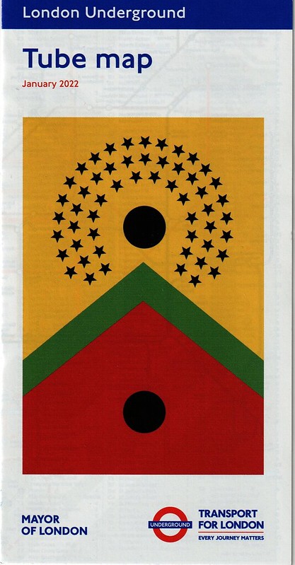
   pocket map January 2022, differences September 2021: - new cover design; "What i Hear i Keep" Larry Achiampong 2021 - Northern Line closure; shown in black/yellow - Borough; dagger added, station closed - Nine Elms to Battersea Power Station; line straightened - Battersea Power Station; boat symbol added - Kennington; connection between Morden line and Charing Cross branch restored - East Acton; dagger added, Eastbound trains and Night Tube services will not stop until mid-May 2022 - Tottenham Hale; step-free to train, restored - Osterley; step-free to platform added - Sudbury Hill; step-free to platform added - "The Night Tube runs on Friday and Saturdays . . . " returned to map |
|
Chris M
Global Moderator
Forum Quizmaster
Always happy to receive quiz ideas and pictures by email or PM
Posts: 19,765
|
Post by Chris M on Jan 7, 2022 13:14:07 GMT
Changes between the September 2021 and January 2022 digital maps:
Northern line closed between Moorgate and junction south of Kennington
in consequence:
- Kennington bank branch blob and connector line to the Charing Cross branch is now greyed out
- Borough shown as closed (struck through with a dagger)
- Charing Cross branch gets a direct link to Morden, requiring Oval to move southwest very slightly
Battersea branch realigned:
- Now dips slightly between Kennington and where the Vauxhall station to pier walk line crosses. Then horizontal all the way to Battersea Power Station, but slightly closer to the river than before.
- Vauxhall moves north west to be closer to the river and its station name
- Nine Elms name now on one line rather than two
- Battersea Power Station has gained a river pier symbol
East Acton gains a dagger
Osterley and Hounslow East move north east a bit, the former is now step free to platform.
Sudbury Hill now step free to platform. Station name moves west slightly to allow this.
Tottenham Hale regains step free access to the train
A large Underground roundel and "Transport for London - Every journey matters" logo has appeared between the eastern Tramlink branches. The "London Trams fare zone" label moves a long way north to get out of its way.
The zone 2 label west of Surrey Quays moves south to be fully away from the gridline
Key moves towards the bottom edge of the map a short distance
|
|
londoner
thinking on '73 stock
Posts: 480 
|
Post by londoner on Jan 7, 2022 22:42:28 GMT
I was at my local station today and saw the tube map but thought the design looked vaguely similar to one I already had (which of course is not true) and ignored it.  Will have to collect it next time I am travelling. |
|
|
|
Post by brigham on Jan 10, 2022 8:51:59 GMT
Still no sign of the much-vaunted Elizabeth Line yet.
I'm sure it's on the larger maps already.
|
|
|
|
Post by Dstock7080 on Jan 10, 2022 10:02:48 GMT
Still no sign of the much-vaunted Elizabeth Line yet. I'm sure it's on the larger maps already. Only as TfL Rail services and no sign of the core on printed or online official maps |
|
|
|
Post by bigvern on Jan 10, 2022 10:26:20 GMT
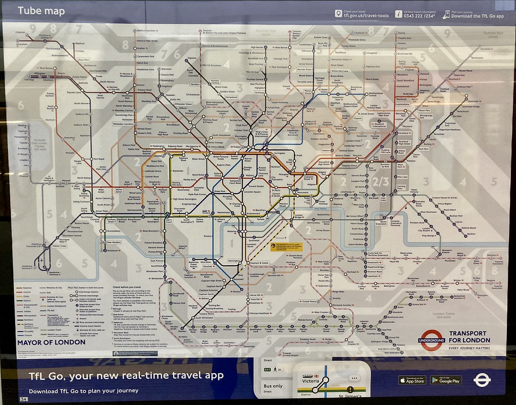
Notice that the Online Tube M|ap has Tfl Rail to Heathrow Terminal 5, but not on this map, also subtle differences with layout like the Victoria Line being clear of Arsenal station. - And the Central Line being Vertical to Epping.
And why does the Hill Hill East branch become shorter at each revision, no reason for this.
|
|
|
|
Post by Chris L on Jan 10, 2022 10:33:15 GMT
It suggests that stations to Gravesend and Sevenoaks are in Zone 8. They're not.
|
|
vincenture
Quiz tryhard, and an advocate for simpler, less complicated rail routes
Posts: 885
|
Post by vincenture on Jan 10, 2022 14:42:40 GMT
Sudbury Hill looks really squished now. The pocket map needs to be one or two folds bigger now lol
|
|
Tom
Administrator
Signalfel?
Posts: 4,196 
|
Post by Tom on Jan 10, 2022 14:57:07 GMT
The whole map looks unnecessarily condensed now - not helped by the addition of the Elizabeth line and Zonal information.
It's starting to look more like the old London Connections map - which was never to my knowledge printed in such a small format.
|
|
|
|
Post by zbang on Jan 10, 2022 16:36:37 GMT
Sudbury Hill looks really squished now. The pocket map needs to be one or two folds bigger now lol From the sound of things, it needs a magnifier, too. (More so than, say, 10 years ago.) |
|
|
|
Post by d7666 on Jan 11, 2022 21:44:30 GMT
Sudbury Hill looks really squished now. The pocket map needs to be one or two folds bigger now lol Indeed needs to be bigger, but I suspect the next move might be to not have printed copies at all, and this will be justified on saving the planet, reducing carbon footprint etc. I'm not saying I agree with such a move, just I predict this soon. I think it is size that leads to the current version of the map being cluttered; there is just too little space for all the information needed. I can see what they want to do, tube + overground, but it is messy. And we don't even have crossrail \ elisabeth on it yet. Being a thameslink user, I always thought the core area ought to be on it, but the whole lot I am less sure about. Kings Cross to London Bridge certainly, unsure about the need for the rest. I think this is one of those issue of not meeting everyones view all of the time. |
|
|
|
Post by brigham on Jan 12, 2022 8:42:46 GMT
I suppose it's one of the penalties of having so many options open...
|
|
|
|
Post by punkman on Jan 12, 2022 9:38:08 GMT
Diamond Geezer discussed this map in his daily blog diamondgeezer.blogspot.com/ on the 8th January (and a follow up on the 10th about those covering the Northern Line part closure); suffice to say he wasn't impressed! |
|
|
|
Post by Deep Level on Jan 13, 2022 8:01:39 GMT
At first glance I thought they'd made a major error at Wimbledon but then realised that it's a connection between the District Line and Thameslink rather than an extra station added to the District Line as it first appears!
|
|
londoner
thinking on '73 stock
Posts: 480 
|
Post by londoner on Jan 13, 2022 13:45:46 GMT
At first glance I thought they'd made a major error at Wimbledon but then realised that it's a connection between the District Line and Thameslink rather than an extra station added to the District Line as it first appears! I am not sure why they did not use a 45 degree interchange symbol instead of the 90 degree interchange symbol. |
|
|
|
Post by johnlinford on Jan 13, 2022 15:25:30 GMT
I presume because of the tram fare zone bubble - a 45 degree would put it on the border of that which isn't right either.
|
|
|
|
Post by Dstock7080 on Jan 15, 2022 10:49:19 GMT
January 2022 poster:  |
|


