Chris M
Global Moderator
Forum Quizmaster
Always happy to receive quiz ideas and pictures by email or PM
Posts: 19,441
|
Post by Chris M on Nov 14, 2022 11:31:44 GMT
This is getting a long way off the original topic, but the issue with "good service" is that it isn't granular enough. There are two strands to how well the service is performing - train intervals and journey time after boarding, to correctly cover all permutations you would need more than the current categories:
Good service - gaps between trains and journey times are both about normal.
Standard intervals - gaps between trains are about normal but journey times may be extended
Standard journey times - journey times are about normal but some gaps between trains may be experienced
Some extended gaps - the interval between some trains is noticeably greater than normal, but journey time is not significantly increased
Extended gaps - It is likely you will need to wait longer for a train, but journey time between stations is not significantly increased and it's usually not worth diverting
Very extended gaps - It is likely you will need to wait significantly longer for a train; it is recommended you seek an alternative route
Slightly extended journey times - train intervals are about normal but journey times between stations are a bit higher than normal
Very extended journey times - train intervals are about normal but journey times between stations are significantly longer than normal, it is recommended to seek an alternative route.
So a line status would be something like:
Jubilee line: Very extended gaps; standard journey times
Metropolitan line: Suspended between Aldgate and Baker Street; Very extended gaps with very extended journey times on the rest of the line
Victoria line: Standard gaps; slightly increased journey times
However this would significantly increase the complexity of the statuses and would need to change more frequently as bunched trains moved along the line.
|
|
Chris M
Global Moderator
Forum Quizmaster
Always happy to receive quiz ideas and pictures by email or PM
Posts: 19,441
|
Post by Chris M on Nov 14, 2022 11:08:29 GMT
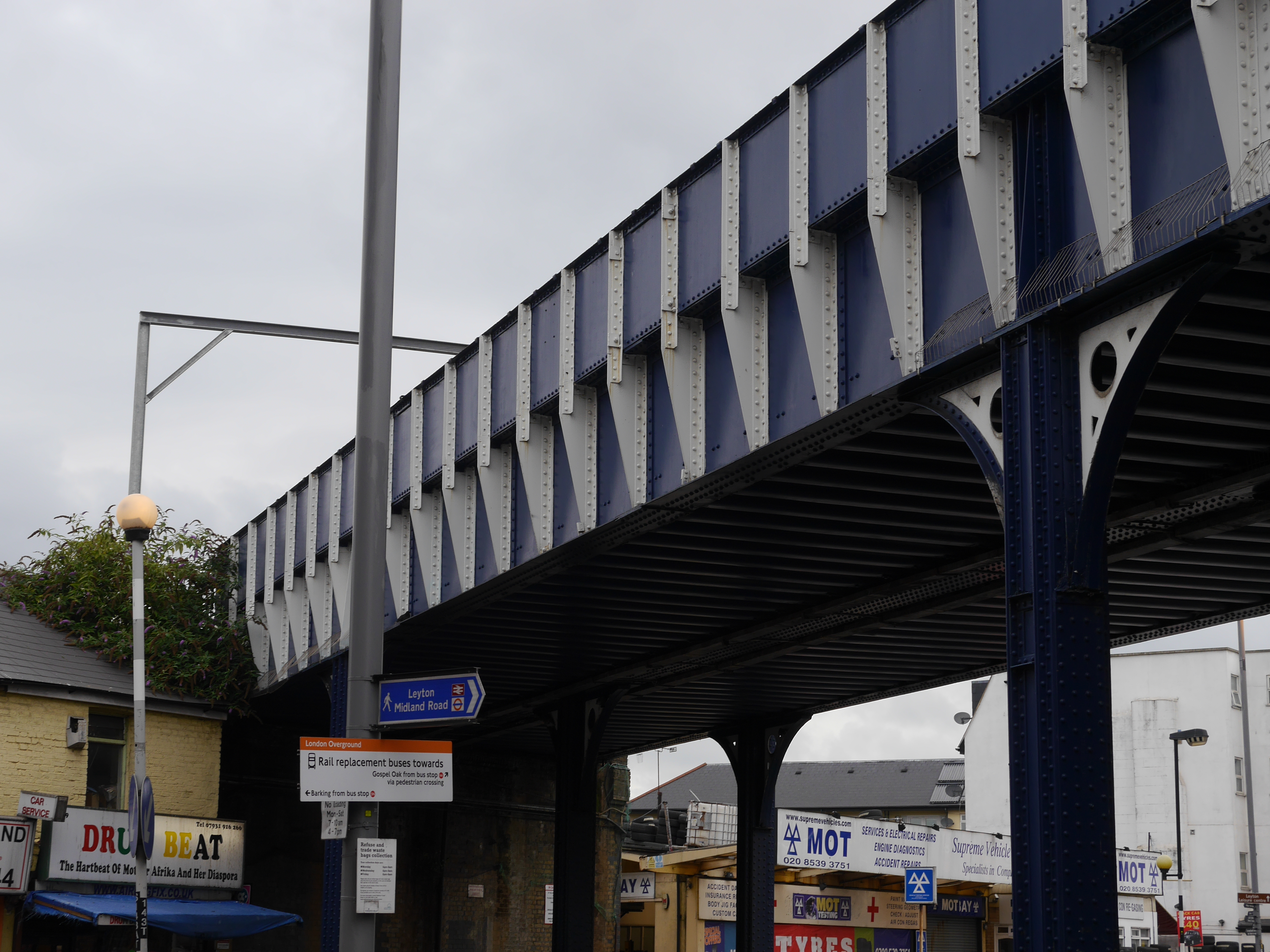
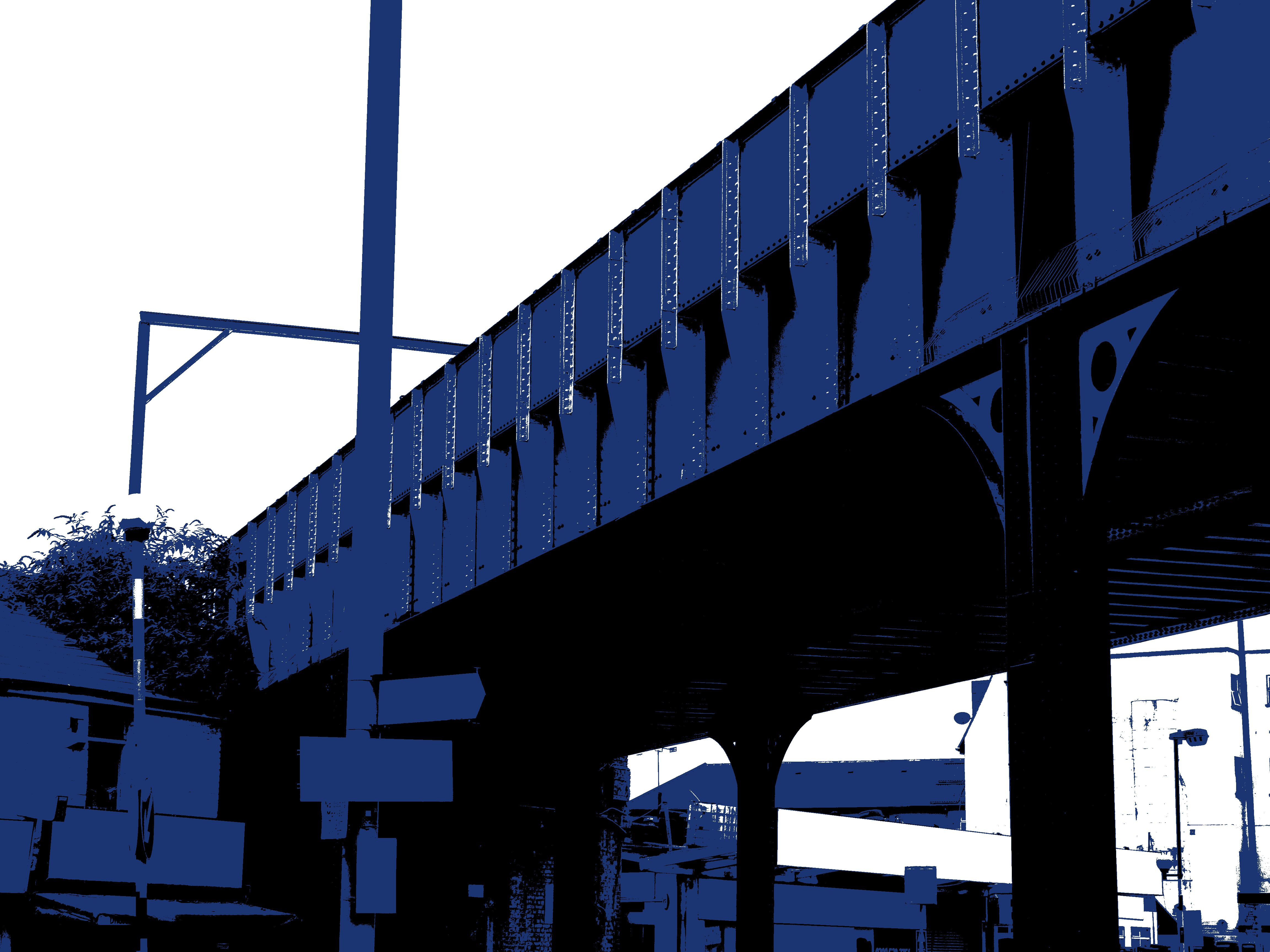
Answer: Between Leyton Midland Road and Walthamstow Queen's Road - bridge over Leyton High Road  (click for a larger version) |
|
Chris M
Global Moderator
Forum Quizmaster
Always happy to receive quiz ideas and pictures by email or PM
Posts: 19,441
|
Post by Chris M on Nov 14, 2022 2:48:49 GMT
There are indeed three parts to the link, you've correctly identified two of them
|
|
Chris M
Global Moderator
Forum Quizmaster
Always happy to receive quiz ideas and pictures by email or PM
Posts: 19,441
|
Post by Chris M on Nov 13, 2022 20:14:33 GMT
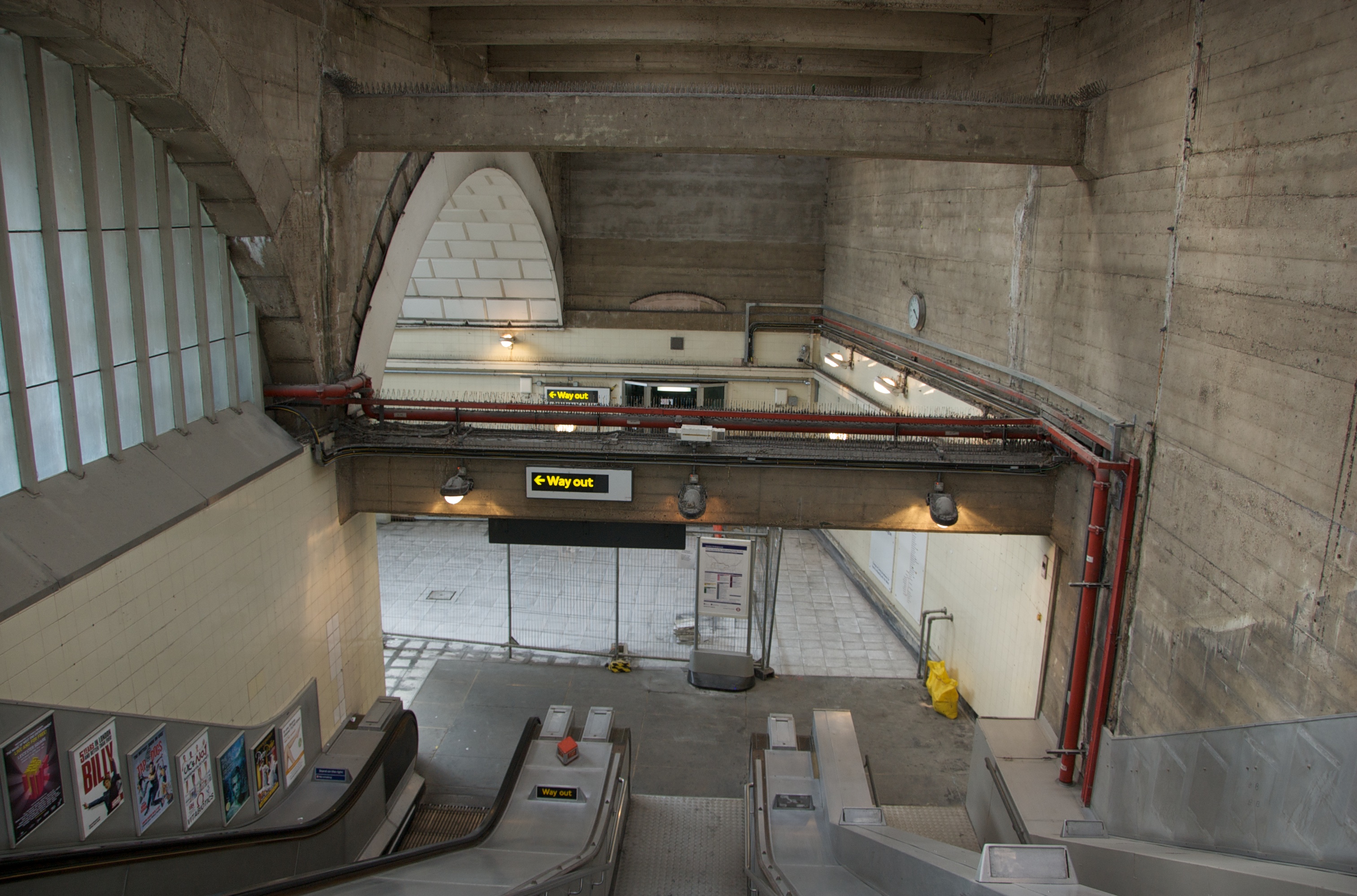
Location B: Greenford - view from top of escalators in July 2010 [ londonstuff]  (click for a larger version) So what is the link between Richmond, Greenford, Slough and Victoria? |
|
Chris M
Global Moderator
Forum Quizmaster
Always happy to receive quiz ideas and pictures by email or PM
Posts: 19,441
|
Post by Chris M on Nov 13, 2022 0:31:38 GMT
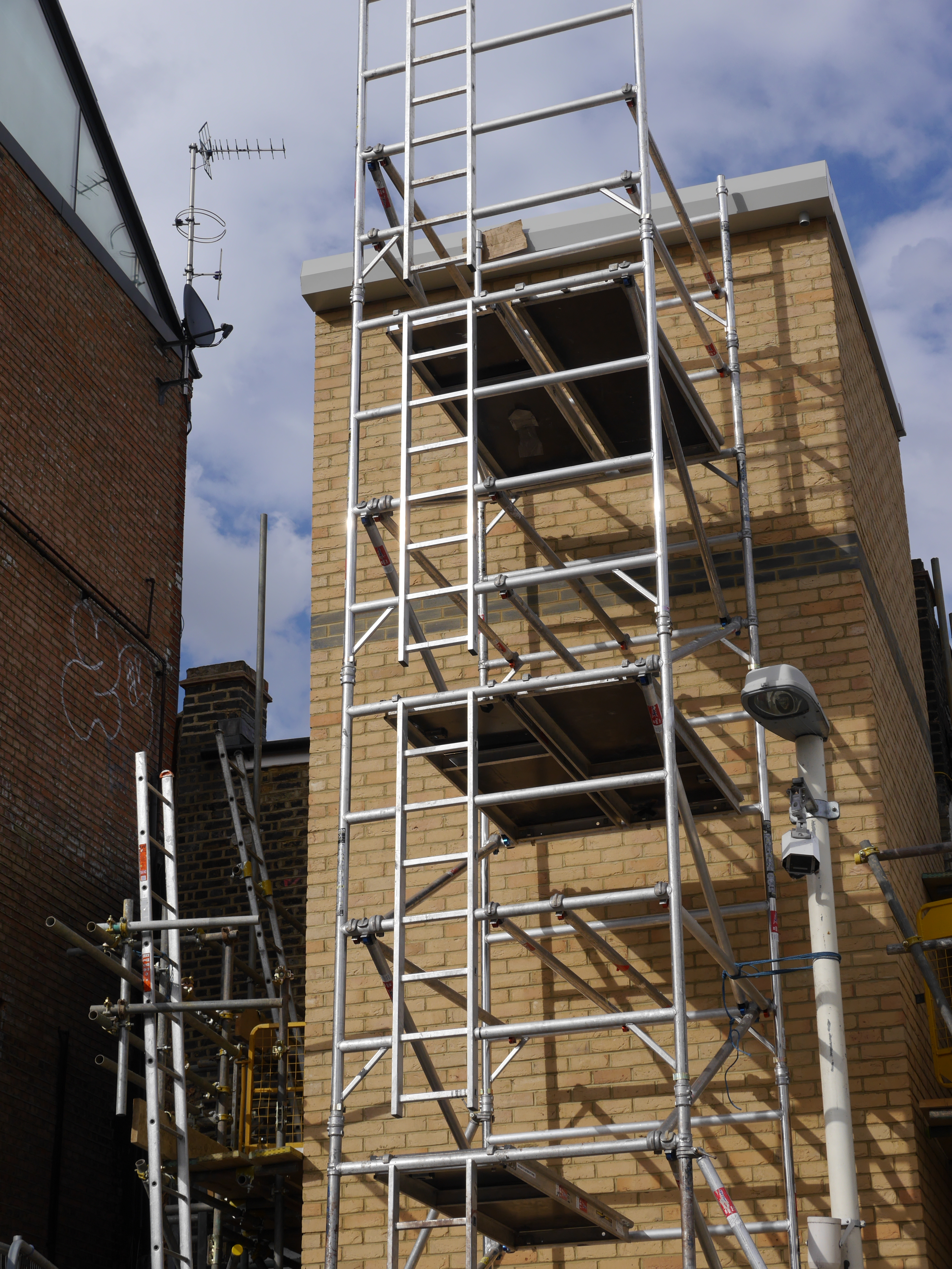
Another single part question for you today:  (click for a larger version) |
|
Chris M
Global Moderator
Forum Quizmaster
Always happy to receive quiz ideas and pictures by email or PM
Posts: 19,441
|
Post by Chris M on Nov 13, 2022 0:27:58 GMT
Location D: Victoria - escalators to new ticket hall in January 2017 [ londonstuff] 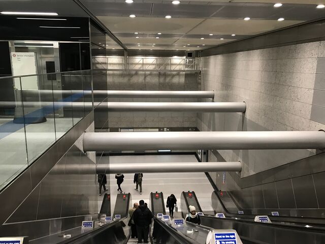 (click for a larger version) Still looking for location B and the link |
|
Chris M
Global Moderator
Forum Quizmaster
Always happy to receive quiz ideas and pictures by email or PM
Posts: 19,441
|
Post by Chris M on Nov 12, 2022 13:31:53 GMT
Sorry for the late start, I'm not sure why Colin didn't post this one when they normally do, but it's just a single part question so hopefully wont be too tricky for you. 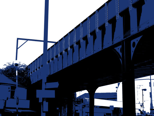 (click for a larger version) |
|
Chris M
Global Moderator
Forum Quizmaster
Always happy to receive quiz ideas and pictures by email or PM
Posts: 19,441
|
Post by Chris M on Nov 12, 2022 13:28:56 GMT
D is not Tottenham Court Road.
|
|
Chris M
Global Moderator
Forum Quizmaster
Always happy to receive quiz ideas and pictures by email or PM
Posts: 19,441
|
Post by Chris M on Nov 11, 2022 12:12:56 GMT
The step-free tube guide is a good thing that should be promoted and available equally as widely as the main tube map, but it doesn't cater to those who can handle escalators but not stairs, nor those who can handle steps but not long walks. The point is to show all that on one map is not possible, so there needs to be a series of accessibility maps, so there is no need to have the misleadingly oversimplified accessibility information on the main map.
|
|
Chris M
Global Moderator
Forum Quizmaster
Always happy to receive quiz ideas and pictures by email or PM
Posts: 19,441
|
Post by Chris M on Nov 11, 2022 2:30:17 GMT
My view is that the people who most benefit from it are those unfamiliar with London, who will primarily be tourists or other visitors. Bearing in mind that many of them wouldn't go outside the central area, is there really a need to show DLR or Trams? Trams are arguable, but for tourists the DLR, Overground and Elizabeth line are no different to tube lines from a practical point of view. Canary Wharf, Greenwich, Stratford, Custom House and London City Airport are destinations of at least equal importance to the likes of Camden, Shepherd's Bush, Hammersmith and Wembley. For a central area map, my limits would be as on the map below. It looks very messy like this, but obviously a proper map would adjust everything to make best use of the space. 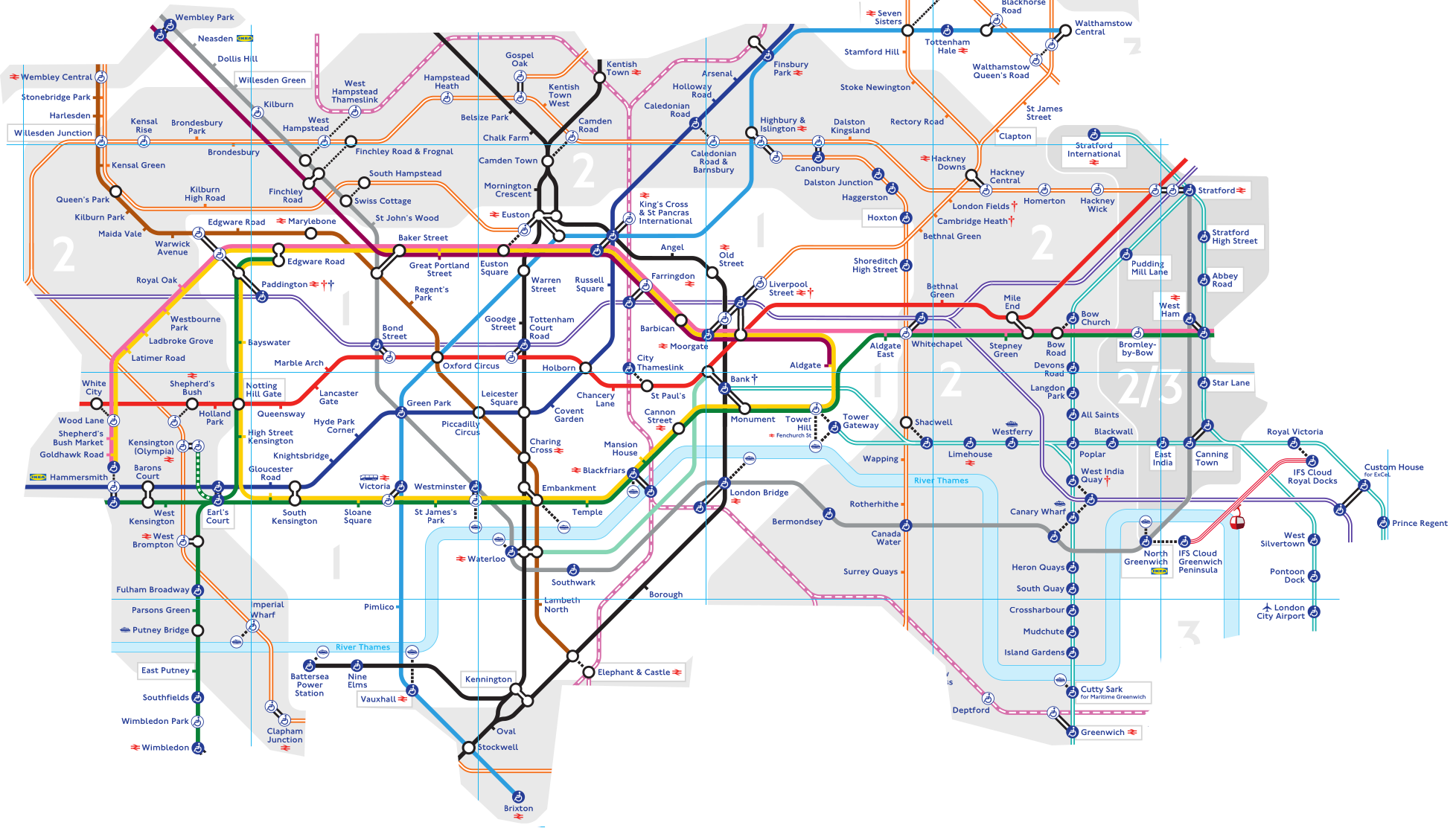 Looking at it again though, I'm not sure that anything south of West Brompton, or north of Willesden Junction Finsbury Park, or Hackney Downs (LO) is needed? Belsize Park definitely isn't needed, so could be omitted if that helps clarity in that part of the map, similarly Surrey Quays. Chalk Farm is needed because Camden Town station can't cope with the crowds, Prince Regent is needed for Excel East.
|
|
Chris M
Global Moderator
Forum Quizmaster
Always happy to receive quiz ideas and pictures by email or PM
Posts: 19,441
|
Post by Chris M on Nov 10, 2022 11:24:27 GMT
There is currently no service on the entire Jubilee line due to the strike action, but for some reason the TfL updates feel the need to note separately that Canary Wharf station is closed, but not any other station only served by the Jubilee.
Canada Water is noted as "part closed" because London Overground trains are not stopping. It's actually fully closed as there is no Jubilee line service either.
Similarly it specifically notes Battersea Power Station and Stemford Brook as closed despite there being no service anywhere near them, but doesn't note the same for any of the other hundred plus stations in the same situation (Oxford Circus, Southwark, Hammersmith, Rayners Lane, Finchley Road, etc, etc)
Why these stations in particular?
|
|
Chris M
Global Moderator
Forum Quizmaster
Always happy to receive quiz ideas and pictures by email or PM
Posts: 19,441
|
Post by Chris M on Nov 10, 2022 10:55:32 GMT
The issue I have with the current map is accessibility. Not because that info shouldn't be available or isn't important, but because the current presentation is simultaneously too complex and not complex enough to be useful to many people.
Assuming I need step-free access the present map tells me I can easily get from Southwark to Bank with a simple interchange at London Bridge. Except I can't, because the step-free interchange at London Bridge requires exiting the station, walking several hundred metres at street level (without signage) before re-entering the same station. The same map tells me that Oxford Circus and Baker Street are completely off-limits to me, but in reality there are plenty of interchanges that I can use them for.
The map shows no indication of walking distances. For example using the step-free route to interchange between the Victoria and Northern lines at King's Cross requires a choice of a very long walk that includes passing through two gatelines (with no indication you wont be charged twice) or a short staircase. For some people the latter is much easier, especially off-peak when there is plenty of space to take the stairs slowly.
It also makes no attempt to cater to those who can manage one or two small steps but not a flight of stairs, or those who are fine on escalators but not fixed stairs. The separate avoiding stairs map does provide this information, along with the vertical and horizontal gap between the train and the station. And herein lies the answer - stop trying to make a one-size-fits-all map and instead produce multiple maps tailored to different needs and promote and distribute them equally.
|
|
Chris M
Global Moderator
Forum Quizmaster
Always happy to receive quiz ideas and pictures by email or PM
Posts: 19,441
|
Post by Chris M on Nov 10, 2022 10:23:27 GMT
Background: Library, Kenwood House in January 2020 [Chris M]
The image above is unmodified.
|
|
Chris M
Global Moderator
Forum Quizmaster
Always happy to receive quiz ideas and pictures by email or PM
Posts: 19,441
|
Post by Chris M on Nov 9, 2022 13:31:12 GMT
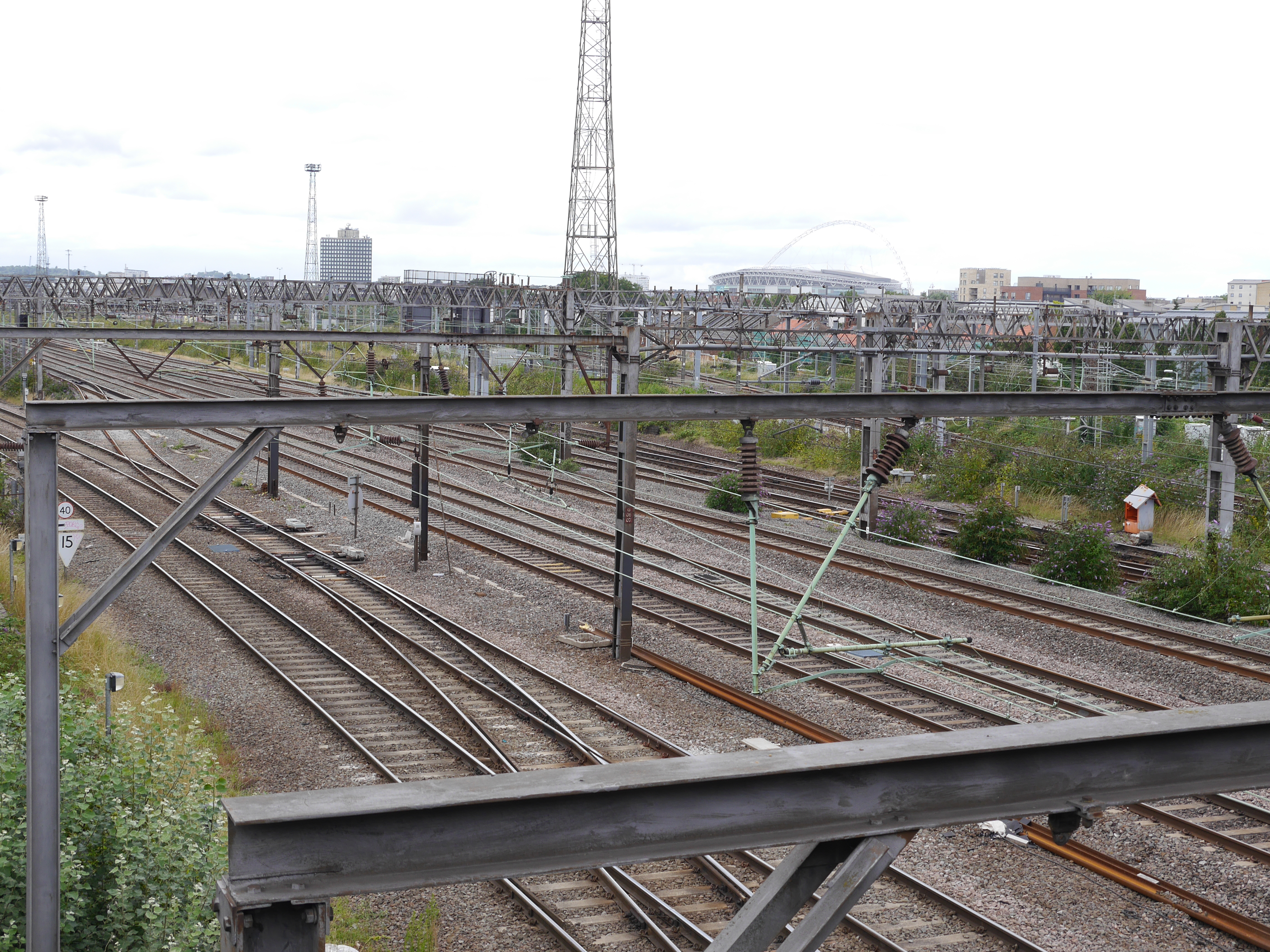
Location C: Between Harlesden and Stonebridge Park - view northwest from Acton Lane in August 2017 [Chris M] 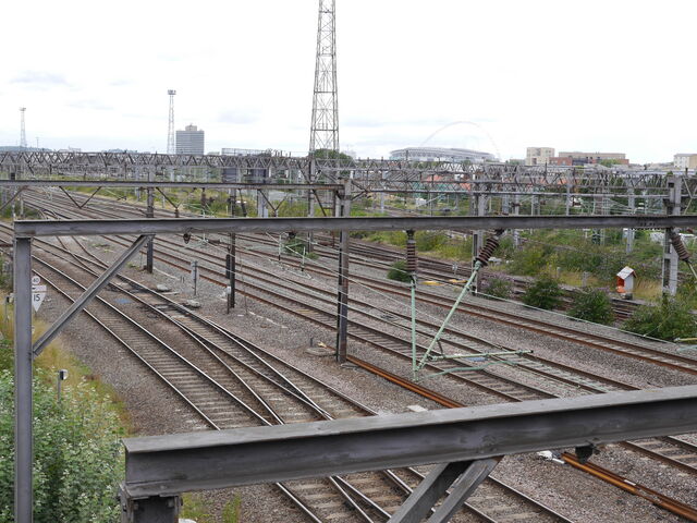 (click for a larger version) |
|
Chris M
Global Moderator
Forum Quizmaster
Always happy to receive quiz ideas and pictures by email or PM
Posts: 19,441
|
Post by Chris M on Nov 8, 2022 22:27:28 GMT
I walked past the new Cannon Street entrance at the weekend. Still seems like a fair bit left to do. Not least of which is filling in the gargantuan hole in the ground behind the station building. I assume that's not actually a prerequisite for opening as I would guess it's for the piles / foundations / basement of the new block that's going on top. The note on the newly released tube map strongly implies that the entrance is due to open in "late December 2022". Given that this just text in a notes panel this would be very easy to change right before going to press, so can be taken as an up-to-date expectation. |
|
Chris M
Global Moderator
Forum Quizmaster
Always happy to receive quiz ideas and pictures by email or PM
Posts: 19,441
|
Post by Chris M on Nov 8, 2022 13:50:58 GMT
Through running of the Elizabeth line has begun:
Paddington loses the lower left, step-free-to-platform blob. The label moves from below the Elizabeth line (lower right) blob to above it and it gains a red dagger (services at these stations are subject to variations) to complement the blue one regarding step-free access to the Bakerloo line
The Elizabeth line west of Stratford now turns southwest to cross the central line and join the Abbey Wood branch at the existing bend east of Whitechapel. To accommodate this, the kink in the Central line for Mile End moves east and Bethnal Green's label changes from one line to two.
At Liverpool Street, the label gains a red dagger and moves from below the LU blob to right of the LO blob. This makes it even less clear which blobs relate to Liverpool Street and which to Moorgate.
There is no indication at either Paddington or Liverpool street that some trains will continue to run into the high level stations.
Bank-Monument reduces from four blobs to three - the DLR is extended west to meet the Northern line at a step-free blob. To keep the straight line, the blob for Monument moves west and that for the central line moves southwest. The Waterloo and City line now shares the Central line blob (no step-free access) rather than the Northern line one's, necessitating the vertical portion of that line move west slightly. The label moves south slightly gains a dagger to note step-free access to Northern line trains is coming in late December 2022. This actually makes more space for the Liverpool Street label, making the decision to move the latter even more odd.
The "(Olympia)" part of Kensington Olympia's label is reduced in size and the NR double arrow moves from the third line to the start of the second.
The dangleway stations gain their sponsored names with "IFS Cloud" preceding Royal Docks and Greenwich Peninsula. The name also changes in the key from "London Cable Car" to "IFS Cloud Cable Car"
Deptford station moves west to be a bit more central between the East London line and DLR.
Nunhead moves from a spacious location west of Elverson Road to a tight spot west of Brockley/New Cross Gate, meaning the label for the latter has to change from the words on one line with the NR double arrow beneath to one word per line with the symbol above.
On the west of the map, the Transport for London (date) watermark moves slightly southwest. It no longer starts beneath the label for Maidenhead but in the gap between the symbol and M, and rathe than the n and s of "Transport" just missing Taplow's label they now run underneath it. The Oyster not valid note moves southwest by the same distance to accommodate. The watermark on the east side of the map also moves east very slightly, I'm guessing this is so the Romford-Upminster branch of the Overground passes neatly between the second and third digits of 2022 while the Goblin passes between "for" and "London" still.
The changes at Bank mean we wont be getting another new tube map this year, and indeed I can't think what the next trigger for change will be.
|
|
Chris M
Global Moderator
Forum Quizmaster
Always happy to receive quiz ideas and pictures by email or PM
Posts: 19,441
|
Post by Chris M on Nov 7, 2022 18:14:29 GMT
The shorter trains are because there aren't enough units to operate the increased frequencies with all three-car trains. This was the case before covid, but during they changed to fewer longer trains as this requires fewer operators
|
|
Chris M
Global Moderator
Forum Quizmaster
Always happy to receive quiz ideas and pictures by email or PM
Posts: 19,441
|
Post by Chris M on Nov 7, 2022 14:23:05 GMT
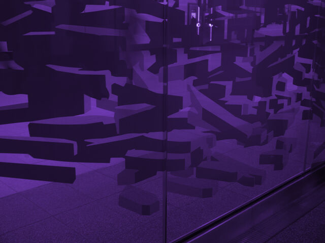
Location: Liverpool Street (Crossrail) - glass in ticket hall [Chris M]  Bonus answer: through services to all Elizabeth line stations start today |
|
Chris M
Global Moderator
Forum Quizmaster
Always happy to receive quiz ideas and pictures by email or PM
Posts: 19,441
|
Post by Chris M on Nov 6, 2022 2:37:34 GMT
My stats show that you have sent me one or more photos of Beckton Park previously, but I have none left in stock so it/they have all been used but I don't have a quick way of identifying when. You have never sent me any photos of Cyprus.
If you or anyone else wants to query whether a photo is yours or not, do feel free to ask on the thread or by PM.
|
|
Chris M
Global Moderator
Forum Quizmaster
Always happy to receive quiz ideas and pictures by email or PM
Posts: 19,441
|
Post by Chris M on Nov 6, 2022 1:05:19 GMT
 (click for a larger version) Bonus question: Why was this location chosen for today? |
|
Chris M
Global Moderator
Forum Quizmaster
Always happy to receive quiz ideas and pictures by email or PM
Posts: 19,441
|
Post by Chris M on Nov 6, 2022 1:04:23 GMT
Answer: Beckton Park - view from eastbound train in March 2019 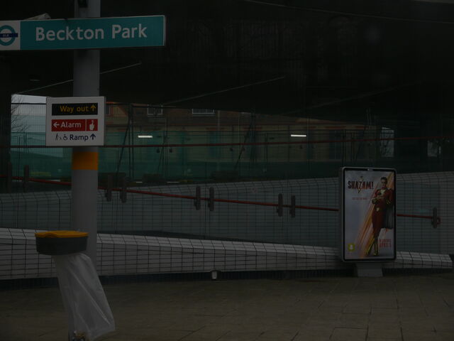 (click for a larger version) |
|
Chris M
Global Moderator
Forum Quizmaster
Always happy to receive quiz ideas and pictures by email or PM
Posts: 19,441
|
Post by Chris M on Nov 4, 2022 18:44:47 GMT
I try to keep uses of locations somewhat balanced, Plaistow was last used in September and that was it's 20th appearance in the quiz (equal to the current maximum) so while it would have worked well with this link it didn't work in the wider context so I swapped it out for a different station that also fits the link.
|
|
Chris M
Global Moderator
Forum Quizmaster
Always happy to receive quiz ideas and pictures by email or PM
Posts: 19,441
|
Post by Chris M on Nov 2, 2022 15:01:02 GMT
Answer: Between Cheshunt Junction and Theobalds Grove - Class 315 passing Westfield Walk in August 2020
|
|
Chris M
Global Moderator
Forum Quizmaster
Always happy to receive quiz ideas and pictures by email or PM
Posts: 19,441
|
Post by Chris M on Nov 2, 2022 13:08:20 GMT
You need to be more specific than that
|
|
Chris M
Global Moderator
Forum Quizmaster
Always happy to receive quiz ideas and pictures by email or PM
Posts: 19,441
|
Post by Chris M on Nov 2, 2022 12:54:37 GMT
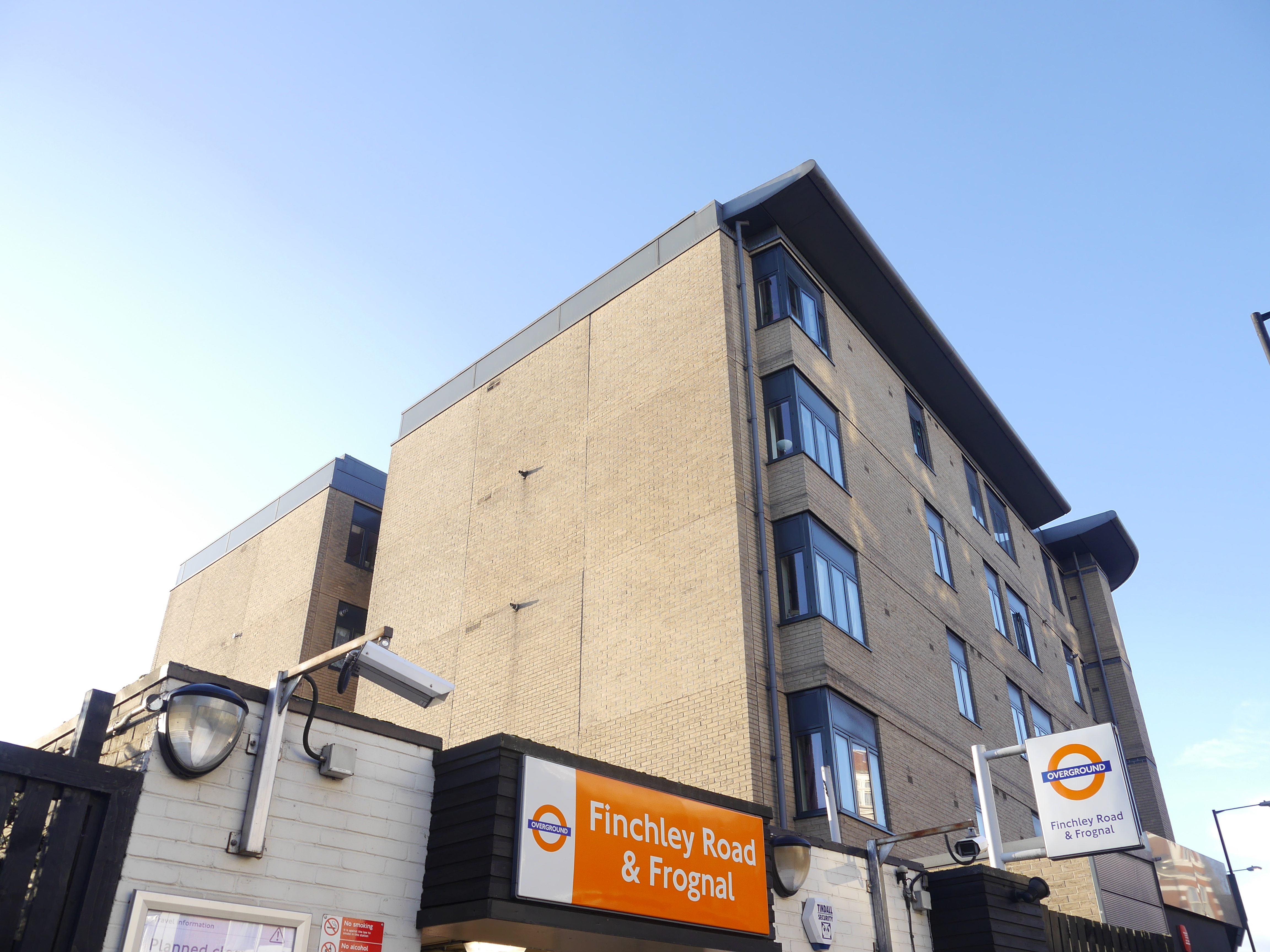
Answer: Finchley Road & Frognal - exterior in January 2018  (click for a larger version) |
|
Chris M
Global Moderator
Forum Quizmaster
Always happy to receive quiz ideas and pictures by email or PM
Posts: 19,441
|
Post by Chris M on Nov 2, 2022 12:54:03 GMT
That's not the right branch either.
|
|
Chris M
Global Moderator
Forum Quizmaster
Always happy to receive quiz ideas and pictures by email or PM
Posts: 19,441
|
Post by Chris M on Nov 2, 2022 3:23:58 GMT
Hello?
|
|
Chris M
Global Moderator
Forum Quizmaster
Always happy to receive quiz ideas and pictures by email or PM
Posts: 19,441
|
Post by Chris M on Nov 2, 2022 0:18:33 GMT
Wrong branch
|
|
Chris M
Global Moderator
Forum Quizmaster
Always happy to receive quiz ideas and pictures by email or PM
Posts: 19,441
|
Post by Chris M on Nov 1, 2022 20:24:59 GMT
You're now on the right network
|
|
Chris M
Global Moderator
Forum Quizmaster
Always happy to receive quiz ideas and pictures by email or PM
Posts: 19,441
|
Post by Chris M on Nov 1, 2022 11:05:35 GMT
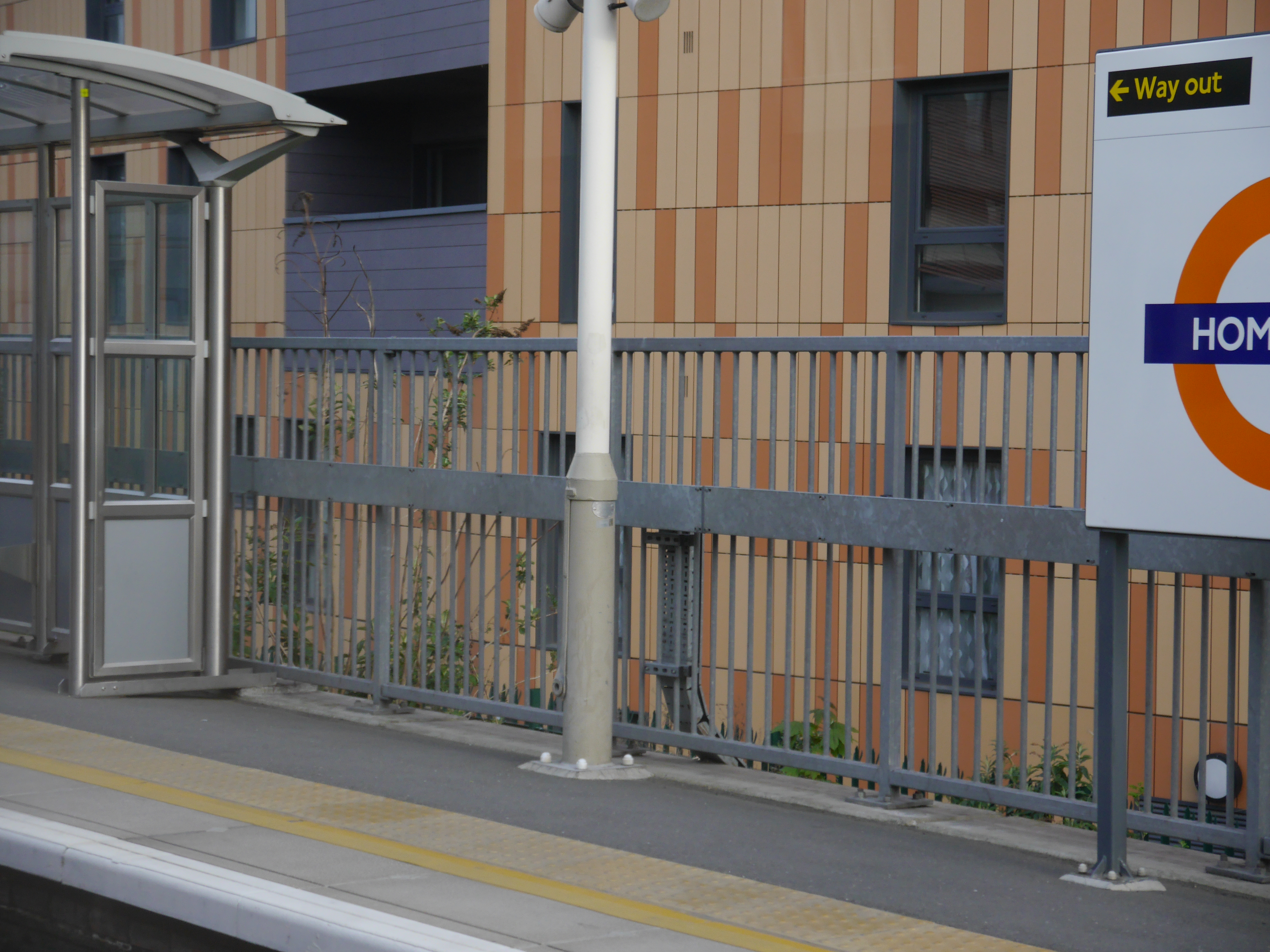
Location B: Homerton - platform 1 from eastbound train in May 2016 [Chris M] 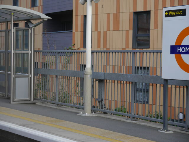 (click for a larger version) |
|